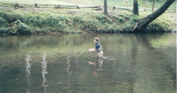
TROUT FISHING IN GEORGIA
Georgia's approximately 4,000 miles of trout streams are relatively unproductive when compared to streams found in other
parts of the country. This is, in part, due to the calcium deficient soils found in north Georgia. Therefore, to meet the
demands of over 100,000 trout anglers, stocking and special regulations are used on some streams to maintain acceptable catch
rates. The Wildlife Resources Division and the U.S. Fish & Wildlife Service stock streams with rainbow, brown and brook
trout from early April through mid-September. The number of trout stocked and the stocking frequency depend on a stream's
fishing pressure, accessibility, and water conditions. In general, streams on public lands are stocked more often and with
greater numbers of trout. Trout fishing opportunities vary and include heavily-stocked high-use streams (better for beginners),
wilderness streams, streams with special regulations, and small impoundments.
Trout need clean, cold water to survive and reproduce. Georgians can be good trout managers by using proper land use practices.
Trees left along stream banks provide shade to keep water temperatures cold while their root systems help stabilize stream
banks and prevent soil from washing into the stream and smothering trout eggs and aquatic insects.
Most trout streams are located on private property and the land owner controls access to, and fishing
rights in, such streams. It is your responsibility to know when you cross a property line. Always get permission from the
land owner before entering or fishing on private property.
Trout Season
Trout season is open from the last Saturday in March through October 31st each year. This year trout season is open from
March 25 - October 31, 2000. Be aware that there are many trout streams open to fishing year-round.
Trout Fishing Hours
Fishing hours on seasonal trout streams, except Waters Creek, are from 30 minutes before sunrise to 30 minutes after sunset.
Night fishing is not allowed.
Fishing 24 hours a day is allowed on year-round trout streams, except those in the paragraph below, and on all impoundments
on trout streams, except Dockery and Rock Creek lakes.
Fishing hours on the Chattahoochee River from from Buford dam to Peachtree Creek, the Conasauga River watershed upstream
of the Georgia-Tennessee state line, and Smith Creek downstream of Unicoi dam are from 30 minutes before sunrise until 30
minutes after sunset. Night fishing is not allowed.
Trout Fishing Rules
Trotlines, set hooks, jugs, nets, bows and arrows, and all other gear except poles and lines cannot be used in trout streams.
Trout anglers are restricted to the use of one pole and line which must be hand held.
Live bait-fish may not be used in any trout stream, except live bait-fish may be used on the Chattahoochee River downstream
of the Roswell Road bridge (Georgia Highway 9). Seining bait-fish is not allowed in any trout stream.
On trout streams designated as "artificials only", only artificial lures may be used. It is unlawful to possess any other
type bait on an "artificial only" stream.
It is unlawful to fish for any fish species in a seasonal trout stream when the season is closed.
Impoundments on Trout Streams
Anglers Can:
Fish for fish species other than trout without a trout license, except on Dockery and Rock Creek lakes.
Fish year-round, except on Dockery Lake.
Fish at night, except on Dockery and Rock Creek lakes.
If you fish for or possess trout, you must possess a trout license. If you catch a trout and do not possess a trout license,
you must release the trout immediately.
Visitors fishing impoundments on State Parks can fish for and possess trout without a trout license. State Park
visitors fishing trout streams must possess a trout license.
GEORGIA'S TROUT STREAMS BY COUNTY
Trout Streams of Georgia This map has been re-printed. Improvements to the map include: streams are printed
in color according to being seasonal, year-round, and special regulation to help anglers, some roads and stream names have
been added, especially on streams located on public land; and the list of recommended streams has been changed to direct beginners
and experts to stocked streams and streams not as heavily used. The map is available from the Fisheries Section. To help DNR
defray printing costs, maps of each county (in PDF format) with trout streams are linked to the county name in the below list
of trout streams. You must have Adobe Acrobat Reader to view and print these maps at home. Acrobat Reader can be downloaded
for free from Adobe's Web site. Simply click on this address www.adobe.com/products/acrobat/readstep
Seasonal Trout Streams are open March 25 - October 31, 2000
Year-round Streams are open to fishing throughout the year and are designated by bold type
Watershed: the stream and all its tributaries (streams flowing into that stream).
NOTE: The following trout streams have special regulations, click here before fishing: Amicalola Creek, Chattahoochee River, Coleman River, Conasauga River, Hoods Creek, Jones Creek, Moccasin Creek, Mountaintown Creek, Noontootla Creek, Smith Creek , Smithgall Woods-Dukes Creek, Stanley Creek, Walnut Creek, Waters Creek
BARTOW COUNTY
Seasonal - Boston Creek watershed upstream from Georgia Highway 20; Toms Creek watershed upstream from Bartow County Road
82.
Year-round -Connesena Creek watershed; Dykes Creek watershed; Pine Log Creek watershed; Pyle Creek watershed; Salacoa
Creek watershed; Spring Creek watershed; Stamp Creek watershed upstream from Bartow County Road 269; Two Run Creek watershed;
Ward Creek watershed.
CARROLL COUNTY
Year-round - Tallapoosa River watershed north of Interstate 20, not including Little Tallapoosa River watershed.
CATOOSA COUNTY
Seasonal - Hurricane Creek watershed upstream from Peters Branch.
Year-round - Dry Creek watershed (part of East Chickamauga Creek watershed) upstream of Catoosa County Road 257; Little
Chickamauga Creek watershed upstream from Catoosa County Road 387; Tiger Creek watershed upstream from Georgia Highway 2.
CHATTOOGA COUNTY
Seasonal - Allgood Branch watershed; Chappel Creek watershed; Chelsea Creek watershed; East Fork Little River watershed;
Hinton Creek watershed; Kings Creek watershed; Mt. Hope Creek (Coon Creek) watershed; Perennial Spring watershed; Raccoon
Creek watershed upstream from Georgia Highway 48; Ruff Creek watershed.
Year-round - Little Armuchee Creek watershed upstream from Chatooga County Road 326; Storey Mill Creek watershed; Taliaferro
Creek watershed.
CHEROKEE COUNTY
Seasonal - Boston Creek watershed.
Year-round - Bluff Creek watershed upstream of Cherokee County Road 114; Pine Log Creek watershed; Salacoa Creek watershed;
Soap Creek watershed upstream of Cherokee County Road 116; Stamp Creek watershed; Wiley Creek watershed.
COBB COUNTY
Year-round - Chattahoochee River downstream to the mouth of Peachtree Creek.
DADE COUNTY
Seasonal - East Fork Little River watershed; Rock Creek watershed.
Year-round - Allison Creek watershed; Lookout Creek watershed upstream from Dade County Road 197.
DAWSON COUNTY
Seasonal - Amicalola Creek watershed upstream from Dawson County Road 192 (Steele Bridge Road) which is the first bridge
upstream from Georgia Highway 53; Amicalola Creek tributaries from Georgia Highway 53 upstream to Dawson County Road 192 (Steele
Bridge Road); Nimblewill Creek watershed; Shoal Creek watershed upstream from the mouth of Burt Creek; Sweetwater Creek watershed.
Year-round - Amicalola Creek from Dawson County Road 192 (Steele Bridge Road) downstream to Georgia Highway 53; Anderson
Creek watershed; Long Swamp Creek watershed.
FANNIN COUNTY
Seasonal - Charlie Creek watershed; Etowah River watershed; Jacks River watershed; Owenby Creek watershed; Persimmon Creek
watershed; South Fork Rapier Mill Creek watershed; Star Creek watershed; Toccoa River tributary watersheds entering the river
downstream from Blue Ridge Reservoir to the Georgia-Tennessee state line and upstream from the mouth of Stanley Creek except
those listed as year-round; Tumbling Creek watershed; Wilscot Creek watershed.
Year-round - Conasauga River watershed (except Jacks River watershed); Ellijay River watershed; Fightingtown Creek watershed;
Mountaintown Creek watershed; Noontootla Creek watershed; Rock Creek watershed; Rock Creek Lake; Toccoa River downstream from
Lake Blue Ridge to the Georgia-Tennessee state line and upstream from the mouth of Stanley Creek (does not include tributaries
unless listed).
FLOYD COUNTY
Seasonal - Johns Creek watershed upstream from Floyd County Road 212; Kings Creek watershed; Lavender Creek watershed upstream
from Floyd County Road 893; Mt. Hope Creek watershed; Toms Creek watershed.
Year-round - Dykes Creek watershed; Little Cedar Creek watershed; Silver Creek watershed upstream of Georgia Highway
1E (Floyd County Road 631); Spring Creek watershed (flows into Etowah River).
FORSYTH COUNTY
Year-round - Chattahoochee River.
FULTON COUNTY
Year-round - Chattahoochee River downstream to the mouth of Peachtree Creek.
GILMER COUNTY
Seasonal - Harris Creek watershed; Johnson Creek watershed; Tails Creek watershed; and all other streams or parts of streams
not listed as year-round except: Coosawattee River downstream from Old Georgia Highway 5 (Gilmer County Road 239);
Talking Rock Creek; and tributaries to Carters Reservoir not listed as year-round (these streams may be fished year-round
without a trout license).
Year-round - Ball Creek watershed; Cartecay River watershed; Conasauga River watershed (except Jacks River watershed);
Coosawatee River from the confluence of Cartecay & Ellijay rivers downstream to old Georgia Highway 5 bridge (Gilmer County
Road 239); Ellijay River watershed; Fightingtown Creek watershed; Mountaintown Creek watershed; Noontootla Creek watershed;
Sevenmile Creek watershed; Town Creek watershed; Wildcat Creek watershed.
GORDON COUNTY
Seasonal - Johns Creek watershed; Pin Hook Creek watershed upstream from Gordon County Road 275; Rocky Creek watershed
upstream from Gordon County Road 210; Snake Creek watershed.
Year-round - Pine Log Creek watershed upstream from Georgia Highway 53; Salacoa Creek watershed upstream from US Highway
411.
GWINNETT COUNTY
Year-round - Chattahoochee River.
HABERSHAM COUNTY
Seasonal - Amy's Creek watershed upstream from Georgia Highway 17; Chattahoochee River tributaries downstream to Georgia
Highway 255 (except Amy's Creek downstream from Georgia Highway 17 and Sautee Creek downstream from Georgia Highway 255 Alternate
bridge); Left Fork Soque River upstream of Georgia Highway 356 and all tributaries to the entire Left Fork Soque River; Middle
Fork Broad River watershed; Nancytown Creek watershed upstream from Nancytown Lake; Right Fork Soque River upstream of Wilson
Falls and all tributaries to entire Right Fork Soque River; Soque River tributaries that enter the river from the confluence
of the Left Fork Soque and the Right Fork Soque rivers downstream to the mouth of Deep Creek.
Year-round - Chattahoochee River downstream to Georgia Highway 255; Left Fork Soque River downstream of Georgia Highway
356 excluding the tributaries; Liberty Creek watershed; North Fork Broad River watershed; Panther Creek watershed; Right Fork
Soque River downstream of Wilson Falls excluding the tributaries; Roberts Branch watershed; Sautee Creek downstream from Georgia
Highway 255 Alternate bridge; Soque River, excluding tributaries downstream from the confluence of Left Fork Soque and Right
Fork Soque rivers to the mouth of Deep Creek; Toccoa Creek watershed.
HARALSON COUNTY
Seasonal - Flatwood Creek watershed; Lassetter Creek watershed; Mann Creek watershed upstream from Haralson County Road
162.
Year-round - Tallapoosa Creek watershed; Tallapoosa River watershed upstream from Haralson County Road 222.
HART COUNTY
Year-round - Savannah River from Hartwell Dam downstream to Richard B. Russell Reservoir.
LUMPKIN COUNTY
Seasonal - Amicalola Creek watershed; Bryant Creek watershed; Cane Creek watershed upstream from the Georgia Highway 9-52
bridge; Cavender Creek watershed; Chestatee River watershed upstream from Tate Bridge (first bridge below Turner's Corner);
Chestatee River tributaries from the mouth of Tesnatee Creek upstream to Tate Bridge; Dockery Lake; Etowah River watershed
upstream from Jay Bridge; Etowah River tributaries from Castleberry Bridge upstream to Jay Bridge; Shoal Creek watershed;
Yahoola Creek watershed upstream from the mouth of Bryant Creek.
Year-round - Chestatee River from Tate Bridge (first bridge below Turner's Corner) downstream to the mouth of Tesnatee
Creek; Etowah River from Jay Bridge downstream to Castleberry Bridge; Yahoola Creek watershed from the mouth of Bryant Creek
downstream to Georgia Highway 52.
MURRAY COUNTY
Seasonal - Jacks River watershed upstream from the Georgia-Tennessee state line; North Prong Sumac Creek watershed; Rock
Creek watershed upstream from Murray County Road 4 (the most southern of the two Rock Creek watersheds that are in the Holly
Creek watershed); Sugar Creek watershed upstream from Murray County Road 4; Sumac Creek watershed upstream from Coffey Lake.
Year-round - Conasauga River watershed upstream from the Georgia-Tennessee state line (except Jacks River watershed);
Dill Creek watershed; Holly Creek watershed upstream from Dill Creek; Mill Creek watershed upstream from Murray County Road
27; Mill Creek (Hasslers Mill Creek) watershed that is in the Holly Creek watershed; Rock Creek watershed (the most northern
of the two Rock Creek watersheds that are within the Holly Creek watershed) upstream from Murray County Road 301.
PAULDING COUNTY
Seasonal - Possum Creek watershed upstream from Paulding County Road 64; Powder Creek (Powder Springs Creek) watershed;
Pumpkinvine Creek watershed upstream from Paulding County Road 231; Raccoon Creek watershed upstream from State Route 2299
(Paulding County Road 471).
Year-round - Pyle Creek watershed; Tallapoosa River watershed; Thompson Creek watershed; Ward Creek watershed.
PICKENS COUNTY
Seasonal- Amicalola Creek watershed upstream from Dawson County Road 192; Cove Creek watershed upstream from Pickens County
Road 294; Fisher Creek watershed; Pin Hook Creek watershed.
Year-round - Ball Creek watershed; Bluff Creek watershed; Cartecay River watershed; Darnell Creek watershed; Hobson
Creek watershed; Little Scarecorn Creek watershed; Long Swamp Creek watershed upstream from Cove Creek; Mud Creek watershed;
Rock Creek watershed; Salacoa Creek watershed; Scarecorn Creek watershed upstream from Georgia Highway 53; Sevenmile Creek
watershed; Sharp Mountain Creek watershed; Soap Creek watershed; Talking Rock Creek watershed upstream from S1011 (Georgia
Highway 136); Town Creek watershed; Wildcat Creek watershed.
POLK COUNTY
Seasonal - Lassetter Creek watershed; Pumpkinpile Creek watershed upstream from Polk County Road 437.
Year-round - Cedar Creek watershed upstream from Polk County Road 121; Little Cedar Creek watershed; Silver Creek watershed;
Spring Creek watershed; Swinney Creek watershed; Thomasson Creek watershed; Thompson Creek watershed upstream of Polk County
Road 441.
RABUN COUNTY
Seasonal - Bad Branch watershed (flows into Lake Seed); Bad Creek watershed (flows into Tugaloo Lake); Bridge Creek watershed;
Crow Creek watershed (flows into Lake Seed); Dickenson Branch (flows into Lake Burton; Dicks Creek watershed (flows into Lake
Burton); Falls Branch watershed (flows into Lake Rabun); Flat Creek watershed; Joe Creek watershed (flows into Lake Rabun);
LaCounts Creek watershed (flows into Lake Seed); Moccasin Creek watershed; Popcorn Creek watershed; Seals Creek watershed
(flows into Lake Seed); Slick Shoal Creek (flows into Lake Seed); Timpson Creek watershed; Wildcat Creek watershed; Worse
Creek watershed (flows into Tugaloo Lake); all other streams or parts of streams not listed below as Year-round. Note: Tallulah
River downstream from Lake Burton dam and tributaries to Burton, Seed, Rabun, Tallulah Falls, Tugaloo, and Yonah lakes not
listed as Year-round are not trout streams and may be fished year-round and without a trout license.
Year-round - Chattooga River upstream from the mouth of Warwoman Creek; Little Tennessee River downstream from US Highway
23-441 bridge; Overflow Creek watershed; Stekoa Creek watershed; Tallulah River downstream to Lake Burton; West Fork Chattooga
River.
STEPHENS COUNTY
Seasonal - Middle Fork Broad River watershed upstream from the NRSC flood control structure No. 44.
Year-round - Little Toccoa Creek watershed; North Fork Broad River watershed upstream from the NRSC flood control structure
No. 1; Panther Creek watershed; Toccoa Creek watershed upstream from Toccoa Falls.
TOWNS COUNTY
Seasonal - Bearmeat Creek watershed; Bell Creek watershed; Bugshuffle Branch (Allen Mill Creek) watershed; Burch Branch
watershed; Fodder Creek watershed; Hog Creek watershed; Shake Rag Branch watershed; and all other streams or parts of streams
not listed as Year-round Note: Hightower Creek downstream from Towns County Road 88; Hiwassee River downstream from Towns
County Road 87; and tributaries to Chatuge Reservoir not listed as Year-round are not trout streams and may be fished year-round
and without a trout license.
Year-round - Brasstown Creek watershed downstream from the US Highway 76 bridge; Charlies Creek watershed; Hightower
Creek downstream from the US Highway 76 bridge to Towns County Road 88; Hiwassee River downstream from Brown Bridge (second
bridge above US Highway 76 on Georgia Highway 75) to Towns County Road 87; Tallulah River.
UNION COUNTY
Seasonal - Arkaqua Creek watershed; Bracket Creek watershed; Butler Creek watershed; Camp Creek watershed; Conley Creek
watershed; Kiutuestia Creek watershed; Low Creek watershed; and all other streams or parts of streams not listed below as
Year-round. Note: Butternut Creek watershed, Nottely River downstream from Nottely Dam, and tributaries to Nottely Reservoir
not listed as Year-round are not trout streams and may be fished year-round and without a trout license.
Year-round - Brasstown Creek watershed downstream from US Highway 76 bridge; Coosa Creek watershed; Ivylog Creek watershed;
Noontootla Creek watershed; Nottely River from the US Highway 129-19 bridge downstream to Nottely Reservoir; Rock Creek watershed;
Toccoa River (does not include tributaries unless listed); Youngcane Creek watershed.
WALKER COUNTY
Seasonal - Allen Creek watershed; Chappel Creek watershed; Dougherty Creek watershed; Dry Creek watershed (tributary to
East Armuchee Creek); East Fork Little River watershed (flows into Dade County); East Fork Little River watershed (flows into
Chattooga County); Furnace Creek watershed; Gilreath Creek; Harrisburg Creek watershed upstream from Dougherty Creek; Johns
Creek watershed; Left Fork Coulter Branch watershed; Rock Creek watershed upstream from Sawmill Branch; Ruff Creek watershed;
Sawmill Branch; Snake Creek watershed; West Chickamauga Creek watershed upstream from Walker County Road 107.
Year-round - Chattanooga Creek watershed upstream from Walker County Road 235; Concord Creek watershed; Duck Creek watershed;
Gulf Creek watershed; Little Chickamauga Creek watershed; West Armuchee Creek watershed.
WHITE COUNTY
Seasonal - Town Creek watershed upstream from the mouth of Jenny Creek; Chattahoochee River watershed upstream from Georgia
Highway 75 Alternate bridge; Chattahoochee River tributaries from the Georgia Highway 75 Alternate bridge downstream to the
Georgia Highway 255 bridge except Dukes Creek watershed downstream from the US Forest Service property boundary; Sautee
Creek; and Smith Creek watershed downstream from Unicoi Dam (these are year-round streams).
Year-round - Chattahoochee River downstream from the Georgia Highway 75 Alternate bridge to the Georgia Highway 255
bridge; Dukes Creek watershed downstream from the US Forest Service property boundary; Little Testnatee Creek watershed upstream
from the mouth of Turner Creek; Sautee Creek; and Smith Creek watershed downstream from Unicoi Dam; Turner Creek watershed
(the one nearest to Cleveland City limits).
WHITFIELD COUNTY
Seasonal - Snake Creek watershed; Swamp Creek watershed upstream from Whitfield County Road 9.
Year-round - Coahulla Creek watershed upstream from Whitfield County Road 183; Dry Creek watershed (part of East Chickamauga
Creek watershed); Spring Creek (Deep Spring Creek) watershed; Tiger Creek watershed.
SPECIAL TROUT STREAM REGULATIONS
While fishing specially regulated waters with a minimum size limit, it is a violation for an angler to possess a trout
which is less than the specified minimum size regardless of where the fish was caught. The following trout streams and portions
of trout streams have special management programs and regulations to provide anglers a variety of trout fishing opportunities:
DELAYED HARVEST STREAMS
Anglers fishing Delayed Harvest Streams must release all trout immediately and use and possess only artificial lures with
single hooks from November 1 - May 14 annually. These restrictions do not apply from May 15 - October 31 of each year. The
following streams are Delayed Harvest Streams:
Amicalola Creek from County Road 192 (Steele Bridge Road) downstream to Georgia Highway 53.
Smith Creek on Unicoi State Park from Unicoi Dam downstream to the Unicoi State Park property boundary.
Chattahoochee River from Sope Creek downstream to Highway 41.
ARTIFICIAL LURES ONLY STREAMS
Only artificial lures may be used in Artificial Lures Only streams. It is unlawful to possess any other type of bait on
an artificial lures only stream.
Chattahoochee River from Georgia Highway 20 to the boat ramp at the National Park Service Medlock Bridge Park immediately upstream of Georgia
Highway 141.
Note: The Chattahoochee River, within the Chattahoochee River National Recreation Area, from Buford Dam to Peachtree
Creek is closed to any use at night (30 minutes after sunset to 30 minutes before sunrise). Anyone in or on the river between
Buford Dam and Georgia Highway 20 bridge must wear a personal flotation device (life jacket).
Coleman River and its tributaries from its junction with the Tallulah River upstream to Forest Service Bridge No. 54.
Conasauga River and its tributaries (except Jacks River watershed) upstream of the Georgia-Tennessee state line are restricted to using
only artificial lures from November 1 through the last Saturday in March (the opening day of trout season) each year. Natural
baits may be used during trout season (March 25 - October 31, 2000).
Hoods Creek and its tributaries on the Warwoman Wildlife Management Area (WMA).
Jones Creek and its tributaries on the Blue Ridge WMA.
Mountaintown Creek and its tributaries upstream of Mountaintown Creek Watershed Structure No. 2 (Hills Lake).
Noontootla Creek and its tributaries on Blue Ridge WMA.
Note: All trout less than 16 inches in length caught from this section of Noontootla Creek must be released immediately.
Stanley Creek and its tributaries on the Rich Mountain WMA.
Walnut Fork Creek and its tributaries on the Warwoman WMA.
OTHER SPECIAL REGULATIONS
Moccasin Creek
That portion of Moccasin Creek between the Lake Burton Hatchery water intake and a sign marking the approximate normal
pool level of Lake Burton is restricted to anglers under 12 years of age and holders of Honorary licenses and is open only
during trout season.
Smithgall Woods - Dukes Creek Conservation Area
Dukes Creek and its tributaries within the state-owned Dukes Creek Conservation Area are open to fishing Year-round by
reservation only. To make a reservation call 706-878-3087.
Only artificial lures with barbless hooks may be used or possessed on the portion of Dukes Creek and its tributaries in
White County on the Conservation Area, including the Georgia Highway 75 Alternate right-of-way. Possession of any bait, lure,
or gear not legal for use on the stream is unlawful.
All fish caught from Dukes Creek and its tributaries in White County on the Conservation Area, including the Georgia Highway
75 Alternate right-of-way, must be immediately released where caught.
No trout may be possessed while fishing on any stream on the Conservation Area or the Georgia Highway 75 Alternate right-of-way.
Waters Creek
Waters Creek is located on the Chestatee WMA is managed for trophy trout jointly by the Wildlife Resources Division and
the U.S. Forest Service, with the Georgia Council of Trout Unlimited cooperating.
Waters Creek and its tributaries are open during the trout season on Wednesday, Saturday, and Sunday only between 6:30
A.M. and 6:30 P.M. Eastern Standard Time (7:30 P.M.. Eastern Daylight Saving Time) with the following restrictions:
Artificial lures with a single barbless hook no larger than a #6 must be used. One lure can be used at a time. You cannot
possess lures that do not meet these criteria while on the area.
Landing nets may not exceed two (2) feet in length.
Possession of any bait, lure, landing net, or gear not legal for use on the stream is unlawful.
All anglers must check in and out of the creek.
No night fishing allowed.
License Requirements:
Residents: Georgia resident fishing license, Trout license, and WMA license. Senior (65+) Lifetime and Honorary License
holders do not need a WMA license.
Nonresidents: Nonresident Georgia fishing license, nonresident trout license, and nonresident WMA license. Florida residents
more than 65 years of age must possess nonresident trout and WMA licenses.
Size limits: 22 inches for brown and rainbow trout and 18 inches for brook trout. It is a violation to possess a
trout smaller than these limits while fishing on Waters creek.
Possession limits:
One (1) trout may be possessed daily.
No person may take more than three (3) trout per season.